Aerial Photography: The Site from Above
The images in this library were captured by a professional aerial survey team during the dry season to show the site’s maximum visual impact. They are organised by development stage and by intended use case so that you can quickly find the shots most relevant to your assessment.
All images are available in full resolution to registered Developer Portal members. The public gallery below is compressed for web display.
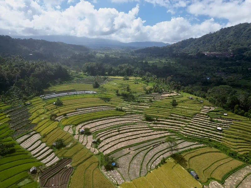
Gallery Categories
- Valley Floor and Stage 1: Road frontage, rice terrace approach, arrival sequence, spring source locations
- Mid-Slope Terraces and Stage 2: Plateau development zones, bamboo forest sections, villa siting opportunities
- Ridgeline and Stage 3 and 4: Upper parcels, 270-degree view angles, elevation context against surrounding landscape
- Infrastructure Context: Road access, Sidemen township, Duda junction, river system
- Gunung Agung Aspect: Shots emphasising the volcano backdrop primary marketing visual asset for resort positioning
- Rice Terrace Agricultural Amenity: Subak terrace system in active cultivation visual context for eco-luxury and cultural positioning
- Sunset and Golden Hour: West-facing shots from ridgeline showing the Duda valley light primary atmospheric imagery
Full-Resolution Downloads
The complete uncompressed image library including raw drone survey footage organised by development stage is available in the Developer Portal to investors who have completed registration. Access includes:
- Full-resolution JPEG files minimum 20 megapixels per image
- RAW format files for the primary marketing shots
- Drone video files full survey footage of each stage, organised by parcel
- Annotated overhead maps showing parcel boundaries and development zones overlaid on drone imagery
Access Full-Resolution Assets
Register for the Developer Portal to download the complete aerial photography library and drone survey video footage.